Race Questions?
- Home
- RRC Races
- Leprechaun Race
- Course & Parking for the Leprechaun Race
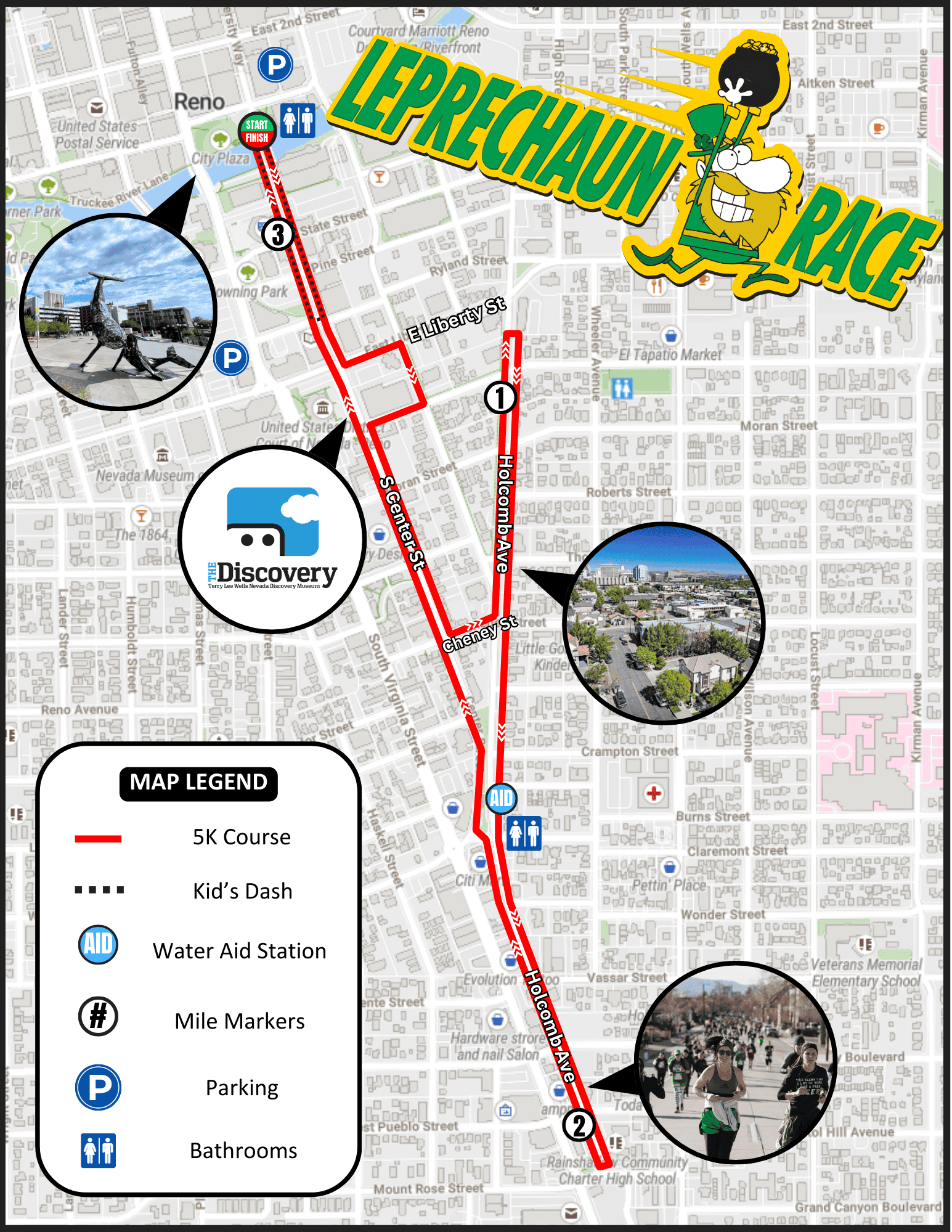
Course Map
*Subject to Change
Course description:
This fast, flat, and festive 5K course kicks off in the heart of Reno at beautiful City Plaza. The route dives into Reno’s vibrant downtown and midtown districts, showcasing colorful neighborhoods, murals, and city energy at every turn. It will also take you on a tour around the iconic Discovery Museum! The race wraps up crossing the Truckee River while you return to City Plaza to celebrate with friends and family!
The Kid’s Leprechaun Dash is a 0.4-mile out-and-back from City Plaza, using the same start/finish arch as the 5K. The kids will run down to Ryland St and back along a coned runner lane. Race staff and volunteers will be positioned along the route to ensure kiddos stay on track and receive lots of cheers along their run!
Parking
Parking will be available at the Washoe County Courthouse parking lot or Downtown Reno’s various public parking lots, casino parking garages or streetside parking spaces.
If you are looking to park at Cal Neva or City Hall parking garages, you will need to approach from the E 1st St and Lake St intersection to avoid the road closures on Center St.
**Please be aware of race morning road closures from 5:00 AM – 10:00 AM on the course at:
- Holcomb Ave
- Center St
- Cheney St
- Stewart St
- Sinclair St
- Liberty St.
Washoe County Courthouse Parking Lot
Address: 201 S Virginia St, Reno, NV 89501
Google Maps Link: Courthouse Parking Lot